Walks in Glendalough: 9 Scenic Walks, Map & Video Guide
A Guide to the BEST Hikes and Walks in Glendalough Ireland
Live Adventure Travel contains affiliate links and is a member of the Amazon Services LLC Associates Program. If you make a purchase using one of these Amazon links, I may receive compensation at no extra cost to you. See my Disclosure Policy for more information.
Glendalough is one of Ireland’s picture-perfect locations and home to some of the best walks in Wicklow. On arrival, you will feel as if you have stepped straight out of a postcard and into an ancient fairytale. The glacier valley is tucked away in the mountains of Wicklow National Park and is home to the Glendalough monastic site, two stunning lakes and countless awe-inspiring hiking trails. The valley is located a short 1-hour drive from Dublin city centre making it one of the best day trips from Dublin and the perfect addition to any Dublin itinerary.
Glendalough is the English translation of the Irish word ‘Gleann Dá Loch’ which means the ‘Valley of the Two Lakes’. Both the upper and lower lakes offer in total 9 hiking trails ranging from easy to advance and range in distance and length. As a result, Glendalough trails appeal to those of all fitness levels. This guide will help those of you considering a visit to Glendalough choose the best hikes and walks in Glendalough for your fitness level, desired time frame and view.
Getting to Glendalough from Dublin
By Car: Glendalough is a one hour drive from Dublin city centre which makes it the perfect addition to any Dublin Itinerary. In fact, it is one of the most popular Day Trip due to it’s close proximity to the city centre. (direction can be seen on Google Maps)
By Bus: A bus service runs between Glendalough and Dublin city centre. A return ticket costs 20 euros.
Day Tours: It is possible to go on day tours from Dublin city centre which sometimes work out at better value than the bus service. You can find tours to suit your ideal day, for example, this one offers a visit to both Glendalough and Kilkenny in one day. Whereas, this one, focuses on Wicklow National Park as a whole.
Walks in Glendalough: A Quick Guide
| Trail Name | Difficulty | Distance | Time |
| Green Road Walk | Easy | 5km | 50 minutes |
| Miners Road Walk | Easy | 5km | 1 hour |
| Poulanass | Moderate | 1.6km | 40 minutes |
| Poulanass and St. Kevin’s Cell | Moderate | 1km | 30 minutes |
| Derrybawn Woodland Trail | Ramble | 8km | 2 hours |
| The Woodland Road | Ramble | 4km | 1 hours |
| Spinc and Glenealo Valley | Difficult | 9km | 3 hours |
| Spinc and the Wicklow Way | Difficult | 11km | 4 hours |
| Spinc (Short Version) | Difficult | 5km | 2 hours |
Easy Walks in Glendalough
Let’s kick start this Glendalough guide with some of the easier valley trails. Before you begin, I recommend stopping by the Glendalough Visitor Centre to pick up ‘the walking trails of Glendalough Guide map‘ to help with navigation. The maps only cost 50c and are extremely helpful in ensuring walkers stay on the right trail. The workers at the information desks are always so helpful and are happy to answer any questions you may have.
| Fun Fact: Glendalough translates to the ‘Glen of Two Lakes’ from the Irish Language. |
Trail 1: The Miners Road Walk (The Purple Route)
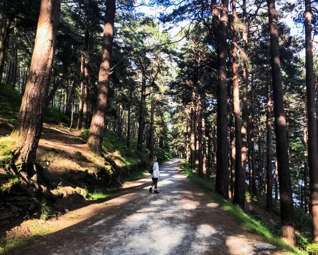
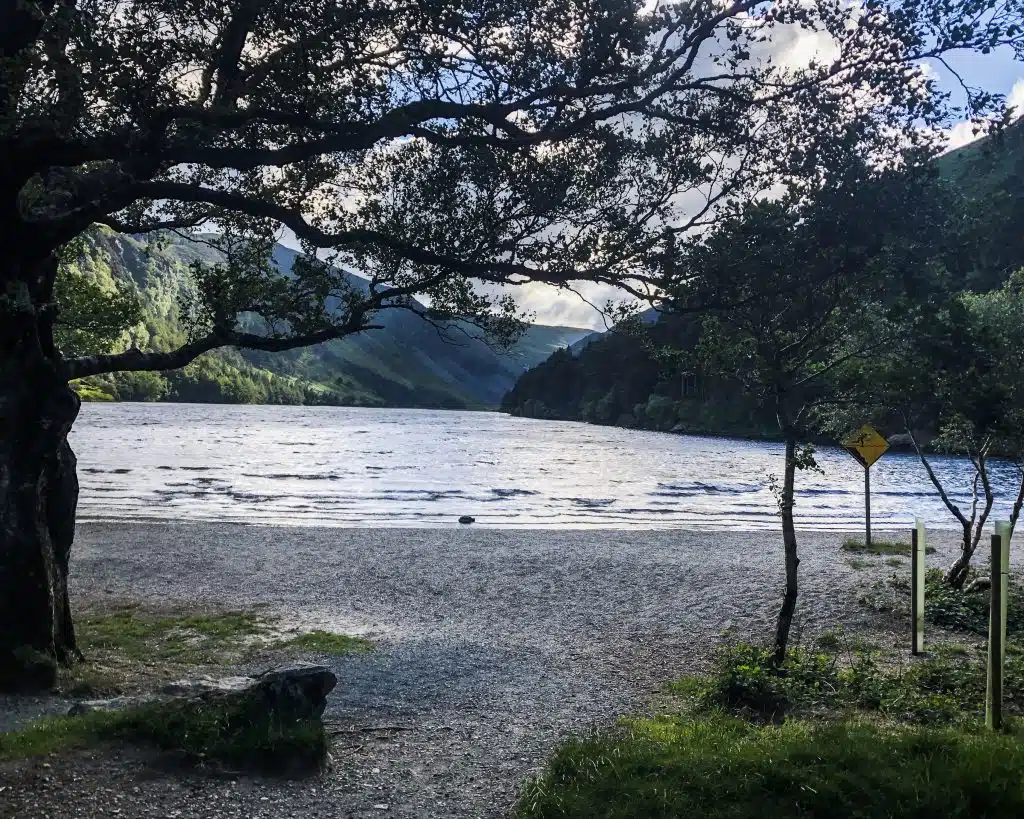
This trail begins at Glendalough Upper Lake just beyond the car park. The beginning of the trail offers beautiful views of the shore of the upper lake and the valley. On the way to the miners, village walkers will pass by through Scots Pine Woodland catching a glimpse of the soaring pine trees as they walk alongside the lake.
Grade: Easy. The trail remains relatively flat throughout and consists of mostly even ground.
Distance: The trail is 5km in total and takes a little over 1 hour to complete.
Points of Interest: Upper Lake, Scots Pine Woodland and Wildlife
Trail 2: The Green Road Walk (The Green Route)
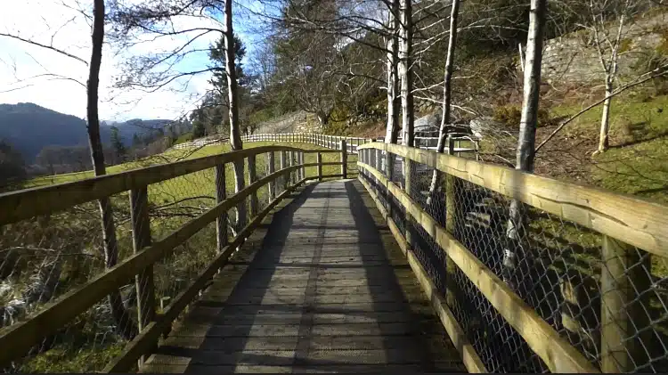
The green road trail is one of Glendalough’s easier trails with flat terrain, mostly consisting of a boardwalk and path’s that brings walkers through the oak woodlands and the lower lake wetlands. This route offers phenomenal views of the Glendalough Valley and is common place for frogs to breed. Once again this trail begins at the upper car park and offers views of the round tower from the Glendalough Monastery.
Grade: Easy. Suitable for all levels of fitness. Adults and Children.
Distance: The trail loop is 5km long and takes about 50 minutes to complete.
Points of Interest: The Monastery, The Lower Lake Wetlands and The Oak Woodlands.
Moderate Walks in Glendalough
There are two walks in Glendalough that are of Moderate difficulty, meaning that they are of short distance but may at times feature a steep incline. Both walks take under 40 minutes to complete.
Trail 3: Poulanass (The Pink Route)
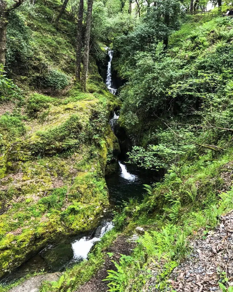
This trail leads to the Poulanass Waterfall. In Irish, ‘Poll an Eas’ means ‘hole of the waterfall’. The route starts at the national park information centre and continue up towards the water fall, eventually passing over the falls and through mixed woodlands.
Grade: Moderate (Is steep starting off)
Distance: The trail lasts for 1.6km and takes about 40 minutes to complete.
Points of Interest: Poulanass Waterfall and Plunge Pools
Trail 4: Poulanass and St. Kevin’s Cell
This short trail is part of the spinc route. It incline steeply along side the Poulanass Waterfall passing St. Kevin’s Cell along the way. It offers beautiful side views and an overlook of the upper lake.
Grade: According to the Glendalough map guide this is a moderate trail, it is however rather steep. There are steps on the trail to help with the incline.
Distance: The trail is 1 km and take about 30 minutes to complete.
Points of Interest: Poulanass Waterfall, St. Kevins Cell and the Upper Lake.
Related Post: One Day in Dublin
Moderate Ramble Glendalough Hikes
According to the glendalough guide map there are two hiking trails that are slightly harder than a moderate rating due to length. The incline of these hikes last for a longer period of time then a typical hike of moderate difficulty.
Trail 5: The Derrybawn Woodland Trail (The orange route)
The orange route is a nice alternative to Glendalough’s hardest trail, the Spinc. The trail offers phenomenal views of the entire valley, so get ready to see the monastery and the upper and lower lake from above. The is even a spot to sit at the top and watch the world go by.
Grade: The Glendalough map guide describes this trail as a ramble, meaning it is of moderate difficulty with prolonged inclines.
Distance: the trail is 8km long and takes about 2 hours to complete.
Point of Interest: The Scenic Valley View Point.
Trail 6: The Woodland Road (The Grey Route)
I have yet to fully complete this trail as I always opt into a route with a better view of the valley. I am however hoping to complete it in the near future as it is supposed to be the most peaceful of the Glendalough trails. According to the Glendalough guide map, the trail begins at the upper lake and leads walkers through the mixed woodlands, into Glendasan Valley and onto St. Kevins Way. It later joins with the green route and brings walkers through the lower lake wetlands.
Grade: Ramble (moderate with a prolonged incline)
Distance: The trail continues for 4km and takes just over an hour to complete.
Point of interest: Woodland and Glendasan Valley/Mines
Related Post: Ireland Packing List
Difficult Hikes or Walks in Glendalough
If you want to check out how Glendalough’s most difficult hike, the Spinc Looks be sure to check out my youtube video <3
Trail 7: Spinc and Glenealo Valley (The White Route)
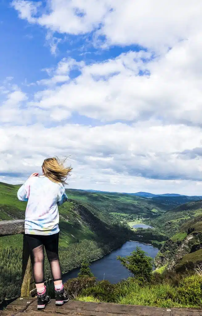
This is my favourite hike in Wicklow National Park and a great addition to your Ireland itinerary. It is by no means a hidden gem but the views are spectacular from the top. Literally, the entire valley can be seen from the mountain top, it’s breathtaking. The trail begins at an incline side by side the Poulanass Waterfall later joining with more than 600 steps that lead walkers through woodland and up to the first viewpoint. This part of the trail reminds me of Ireland’s Stairway to Heaven in County Fermanagh. The first half of the trail circles around the valley on a boardwalk, later joining with rocky terrain. This is a hard hike but totally work the effort for the scenic views throughout.
Grade: Difficult ( I’d recommend wearing hiking boots)
Distance: The Spinc and Glenealo Valley trail is 9km long and takes over 3 hours to complete (In the snow it took me nearly 6).
Point of Interest: View points of Upper Lake, Lower Lake and Glendalough Monastery.
Trail 8: Spinc and the Wicklow Way (The Red Route)
The Spinc and the Wicklow way begins just like the Glenealo Valley trail, it follows the boardwalk all the way to the second viewpoint, however, walkers turn off at Lugduff Mountain and continue along the Wicklow Way.
Grade: Difficult (Again hiking boots are needed)
Distance: The trail is 11km and takes 4 hours to complete.
Points of Interest: The Glendalough Valley View Points and the Wicklow Way hiking trail.
Trail 9: Spinc (Short Version) (The Blue Route)
This route begins just like the other Spinc routes, by the Poulanass Waterfall. The steep incline through the forest brings walkers to the first viewpoint of the Lower Lake and Monastery. The trail then continues along the Spinc boardwalk to the second viewpoint, however, instead of following the loop back to the lower lake walkers turn off to a forest area which leads back to the starting point.
Grade: Difficult
Distance: The hike is 5km in length and takes 2 hours to complete.
Points of Interest: Spinc viewpoints
The Glendalough Monastery
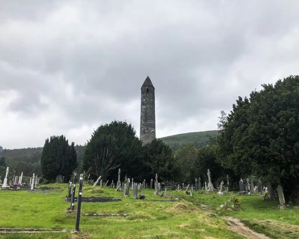
Ok, so the Glendalough monastic site isn’t really a trail, but it is 100% somewhere worth having a walk around. It was founded by St. Kevin in the 6th century and lies before the Lower Lake. The historic site from ancient Ireland survived many Viking attacks and was used as a school until the Normans destroyed the Monastery in 1214 A.D. The current remaining ruins date back to 10th and the 12th centuries, making it one of Ireland’s most popular attractions.
Where to stay near Glendalough
My favourite place to stay when planning an over night stay at Glendalough is the youth hostel. It is super affordable and in a central location to all popular attractions. The staff are more than welcoming and are so helpful.
What Weather to Expect at Glendalough
The weather in Glendalough can be unpredictable, you never really know what you are going to get till you are there. So, it is important to come prepared with a good Ireland packing list. Oh! and be mindful that it is one of the few places that commonly see’s snow in Ireland in the winter months.

Where to eat at Glendalough
Ok, so after a long day of hiking and exploring. I’m sure your tummy will be rumbling like crazy and in need of some Delish food. My favourite place to eat when visiting Glendalough would have to be the Wicklow Heather restaurant in Laragh. Only a 5 minute drive from the Glendalough Youth Hostel. They even offer a taxi pick up service around the area so guest can have a cheeky drink without having to worry about getting home. The service here is top notch and the atmosphere is great. I’d 100% recommend checking it out on your next Glendalough visit. Make sure to check out my Ireland tipping guide before booking a table.
I hope you enjoyed this post and I wish you the best of luck on your visit to Glendalough. Most of this information is referenced from the Glendalough guide map which can be purchased in the visitor centre for 50c. No matter how many times I visit Glendalough, I always bring my map to ensure I don’t get lost.
Have a Ireland Travel Question?
Then join my FREE Facebook Community, I pop in once a week to answer as many queries as possible. Please do not email or DM. It is easier for me to manage everything in the one place 😊
*BE SURE TO TAKE A LOOK AT MY GLENDALOUGH VLOG OVER ON MY YOUTUBE CHANNEL*
Thanks for reading!
I hope you enjoyed this post and have an amazing time on your trip to Ireland. If you need any help with your planning feel free to message me on Instagram or Facebook 🙂
*Disclaimer: This post contains affiliate links meaning I may make a small income at no extra cost to you*
PIN ME FOR LATER
